- Drilling without a geophysical survey gives you a 50-60% chance of success. A proper survey lifts that to 85-95%, according to BoreholeHub South Africa.
- A residential hydro survey costs R5,000 to R28,000 depending on method. An Electrical Resistivity Tomography (ERT) survey runs R15,000 to R30,000. The survey typically represents about 5% of total project cost.
- The four things a professional survey tells you before a single metre is drilled: water table depth, optimal drill location, expected yield in litres per hour, and likely water quality including contaminants.
- South Africa’s national borehole database holds 281,600 records. A qualified hydrogeologist cross-references this data with on-site geophysics, a device-only operator cannot do this.
- Airlift (blow) yield quoted during drilling is NOT the sustainable yield. Only a SANS 10299-4 pump test produces a defensible sustainable yield figure.
- Legal liability for non-compliant drilling rests with the property owner, not the contractor. A pre-drilling survey that checks servitudes and restricted zones is also legal protection.
- In Pretoria, 37.5% of homes already have boreholes. Aquifer depletion is a documented risk, Beaufort West saw a 25-metre water table drop over 20 years from over-extraction.
In October 2025 a video went viral on South African TikTok. A homeowner had spent R70,000 drilling 200 metres. No water. The comments filled with fury, disbelief, and stories that sounded identical.
“You search for water first, then drill. That’s their job. If there’s no water, what are you paying for?”
That commenter had distilled the entire problem in two sentences. This guide expands on it, with real numbers and real data, so you can approach a borehole project the way it should be approached: survey first, drill second, never the other way around.
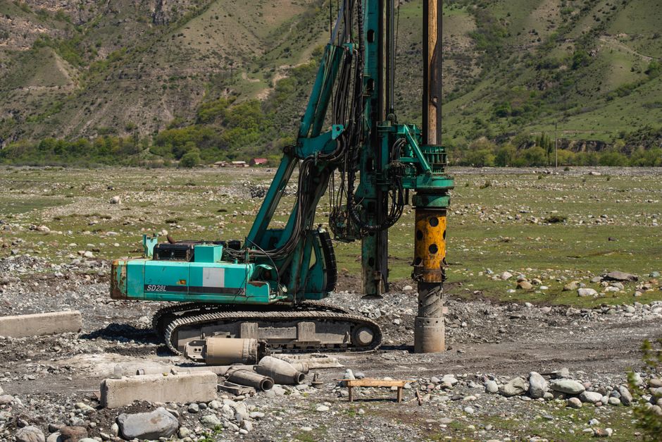
Why the survey step is not optional
South Africa’s groundwater picture is genuinely complex. The BGS Earthwise hydrogeology profile of the country notes that most aquifers here exist in fractured rock domains. The IGRAC groundwater country profile breaks the country’s geology into three broad zones: major aquifers with high permeability covering about 18% of the country; minor aquifers with moderate permeability covering about 67%; and poor aquifers with low permeability and minimal exploitable groundwater covering the remaining 15%. In practical terms, this means roughly one in six properties sits above ground that is structurally resistant to yielding usable water from a standard residential borehole.
Even within a single farm or suburban plot, the difference between a productive borehole and a dry one can be a lateral distance of 20 metres. In the Karoo, the Water Research Commission notes that groundwater potential is highest where the host rocks are predominantly sandstones rather than mudstones, and those two rock types can alternate at sub-surface intervals that are invisible from the surface. In Johannesburg, hard rock begins within a few metres of the surface and the water table sits 30 to 100 metres down, well beyond any wellpoint. The BWASA Layperson’s Guide confirms that viable quantities of water can be obtained at 30 metres in some areas, while in others a hole may need to go beyond 150 metres.
Without a survey, you are choosing your drill point on the basis of aesthetics, convenience, or gut feel. With one, you are choosing it on the basis of geophysical data, geological mapping, and 281,600 historical borehole records held in the National Groundwater Archive.
“Without a comprehensive borehole water survey, drilling for water is like playing the Lotto; chances are it is going to cost you a lot more than you think, and you might not actually find water.”
What a hydro survey actually measures
The term “hydro survey” covers a spectrum of methods. They are not equivalent. Here is what each method actually does and what you get from it.
Geological and hydrogeological mapping (basic)
The starting point for any survey is a desktop assessment using existing geological maps, the National Groundwater Archive, satellite imagery and topographic data. A qualified hydrogeologist uses this to identify probable aquifer types, known fracture zones, and historical yield data for the area. According to Enviroleg, this phase costs R5,000 to R10,000 for a residential property. OurPower.co.za’s borehole cost calculator puts the equivalent basic site siting exercise at R3,000 to R8,000. Aqua Precision publishes a dedicated groundwater survey starting price of R3,500 to R5,000.
On its own this is useful context, but it does not provide the on-site resolution needed to place a drill point accurately. It should be treated as an input to, not a substitute for, geophysical work.
Electrical Resistivity Tomography (ERT)
ERT is the workhorse method for residential and agricultural borehole siting in South Africa. The equipment injects electrical current through surface electrodes and measures the resulting voltage, producing a high-resolution cross-section image of what lies beneath the ground. According to SEP Geophysical, ERT maps lithology, water saturation, fluid conductivity, porosity, permeability, fractures and groundwater simultaneously. The depth of investigation is typically 20% to 40% of the outer electrode spacing, and most South African surveys use 64 electrodes. Ultra BoreHoles states that their resistivity surveys achieve depth accuracy within plus or minus 5 metres in most Gauteng geology.
ERT survey costs range from R15,000 to R30,000, confirmed by both ICT4Health and Rainbow Reservoirs independently. Enviroleg puts geophysical surveys using ERT at R10,500 to R28,000 for a comprehensive package including a full written report. In urban settings, Enviroleg cites accuracy rates of 85 to 90% for locating productive water sources using this method.
Transient Electromagnetic (TEM) surveying
TEM uses pulsed magnetic fields to induce eddy currents in the subsurface and analyses how the secondary electromagnetic field decays to detect resistivity variations. The key advantage over ERT is depth: TEM can profile groundwater conditions from 10 metres to 300 metres, according to a review of geophysical data acquisition methods published in ScienceDirect. This makes it the preferred tool where aquifers are deep, including parts of the Northern Cape and the deeper Karoo formations. BoreholeHub South Africa lists TEM alongside electromagnetic (EM) and ground penetrating radar (GPR) as the core suite of geophysical methods used in professional hydro surveys.
Electromagnetic (EM) surveys
Electromagnetic surveys are widely used for initial reconnaissance across larger land areas, particularly for agricultural and commercial projects. Rainbow Reservoirs publishes base pricing at R500 to R1,500 per square kilometre nationally, rising to R8,000 to R12,000 per square kilometre in Gauteng and Mpumalanga. A flat-fee starting price for a basic EM survey is approximately R20,000 according to ICT4Health. Enviroleg states that EM surveys can boost borehole development success rates by up to 80%. The full cost ceiling for a multi-method geophysical survey using EM, ERT and GPR combined can exceed R80,000 for complex or large-scale commercial projects.
Ground Penetrating Radar (GPR)
GPR is most useful for identifying shallow water tables and underground infrastructure. Rainbow Reservoirs prices GPR work at R2,500 to R10,000 per day, inclusive of equipment and basic data processing. Because the penetration depth is limited, GPR is most commonly deployed as a complementary layer rather than a standalone borehole siting tool.
Magnetic surveys
Magnetic surveys detect anomalies in the earth’s magnetic field that indicate structural features such as dykes, faults and fracture zones. Enviroleg puts basic magnetic surveys (depth to approximately 30 metres, suitable for residential and small agricultural projects) starting at R2,500, with the Free State regional example also cited at approximately R2,500. High-resolution magnetic surveys for complex projects run R10,000 to R25,000. ICT4Health lists magnetic surveys as a complementary method priced at R10,000 to R20,000.
What the final report must contain
A professional hydro survey is not a verbal statement or a single GPS pin dropped on your lawn. Dr Roger Parsons, a hydrogeologist with more than 40 years of experience and a Gold Water Medal recipient, reviewed 20 borehole siting reports received from across the South African market and published his findings in Daily Maverick in April 2026.
“With a rare exception, none is authored by individuals with tertiary training in earth sciences, if any tertiary qualification at all. Reports are unsigned or authors not even identified. Even with my training, I no longer conduct geophysical surveys myself, the equipment is costly, increasingly complex and requires specialist interpretation. When needed, I subcontract qualified geophysicists.”
His minimum professional document standard for a borehole siting report requires: a recommended drill point, the expected depth, the anticipated yield, labelled graph axes, and units of measurement on every figure. Ultra BoreHoles describes their deliverable as a PDF containing a depth estimate, expected yield, risk factors, and a fixed-price drilling quote. LiquaFlo’s checklist specifies that the four data outputs a proper survey must determine are: (1) water table depth, (2) optimal drilling location, (3) expected yield in litres per hour, and (4) water quality including potential contaminants.
If the report you receive does not contain all four of those elements, authored and signed by a person with identifiable qualifications, it does not meet the minimum standard. Treat it accordingly.
“There’s nothing that can show you where your water is. You have to understand the geology, identify a good target zone, and then drill.”
The devices you should not trust
The SA market is currently flooded with Chinese-made “groundwater detector” devices selling for approximately R15,000. Dr Parsons addressed them directly in the same Daily Maverick piece:
“If something is too good to be true, it usually is. You’d be just as well off buying a fine bottle of red wine, settling into a camping chair, tossing the cork over your shoulder and drilling where it lands. That spot is every bit as reliable as one chosen by a ‘groundwater detector’.”
Conventional professional geophysical systems cost between R800,000 and R3,000,000 according to Enviroleg’s equipment pricing data, which Dr Parsons corroborates from his own practice. A device at R15,000 does not contain the sensor array, processing software or calibration required to produce defensible subsurface data. The problem is not only that these devices give unreliable readings. It is that operators using them produce written reports that look like professional survey documents but lack any qualifying author, labelled axes, or methodology description. The survey cost as a fraction of total project expenditure is approximately 5%, according to Rainbow Reservoirs. Paying for a real one is the straightforward decision.
Understanding yield: the critical difference between airlift and sustainable
One of the most expensive misunderstandings in the South African borehole market stems from a single number: the airlift yield. GEOSS South Africa’s published guidance is explicit on this point.
“The driller normally provides the client with a blow yield. This yield is often mistakenly used as the sustainable yield of the borehole, resulting in the incorrectly sized pump being installed into the borehole. This can have several negative outcomes including over-abstraction of the borehole resulting in burned-out pumps and high electricity bills.”
The airlift yield is measured during drilling, typically over a very short period, and represents how much water can be blown out under compressed air pressure. GEOSS describes it as an estimate of water that can be expelled over a very short period and often an overestimate of the rate at which the borehole may sustainably be pumped. The BWASA’s Guidelines document, which includes the composite owner case study known as “The Story of Jimmy Lostwell”, records this exact situation from real practice: a driller verbally indicated approximately 1,500 litres per hour; a subsequent pump test revealed the actual sustained yield was only 500 litres per hour.
The only standard that produces a defensible sustainable yield figure is SANS 10299-4:2003, the South African National Standard for test pumping of water boreholes. The Department of Water and Sanitation will only authorise groundwater use if this standard has been applied. The protocol requires four to six pumping steps of one hour each at incrementally increasing rates, yield measured at least three times per step, and water level recovery monitored until within approximately one metre of the static water level or for approximately 12 hours after pumping stops. A hydrogeologist then analyses the rate of drawdown relative to water strike depths to calculate a pumping rate that will keep water levels above those depths over long periods while rainfall and aquifer recharge can replace the abstracted volume. The key hydraulic parameters this produces are transmissivity, radius of influence, storage coefficient, and specific capacity. A yield test costs R1,500 to R5,000 according to Enviroleg. Aqua Precision prices a combined yield and water quality test at R4,000 to R7,000. Comprehensive borehole testing including equipment performance assessment can reach R10,000.
The national yield range across South Africa is less than 500 litres per hour to more than 5,000 litres per hour depending on area and groundwater conditions, according to Borehole Guide ZA. A borehole producing 1,000 litres per hour pumped continuously delivers 24,000 litres per day. In Johannesburg, LiquaFlo’s client data puts typical residential daily yield at 4,000 to 12,000 litres per day depending on depth and geology. Neither number is useful unless it is a sustainable yield, not an airlift estimate.
Water quality: what the survey should test and why it matters
A proper pre-drilling assessment and a post-drilling water quality test are two different things, and both are necessary. The pre-drilling survey identifies proximity to contamination sources, land use history, and geological indicators of problematic chemistry. The post-drilling laboratory test measures actual water quality parameters against SANS 241:2015, the South African National Standard for drinking water quality.
Parameters that a South African groundwater assessment should cover include: pH, electrical conductivity (EC), temperature, oxidation-reduction potential (ORP), ammonia, calcium, chloride, fluoride, hardness, magnesium, manganese, nitrate, sulphate, turbidity, E. coli and total coliform counts, according to research published in MDPI Water. Real Eastern Cape borehole data from the Thyspunt area illustrates the range: confined aquifer pH measured at 6.14 (marginally acidic); unconfined aquifer pH at 8.02 (marginally alkaline); EC ranging from 286 to 7,040 microsiemens per centimetre across different sampling points. That EC variation alone spans the difference between excellent drinking water and water that is unacceptably saline without treatment.
Water quality laboratory testing must be conducted at a SANAS-accredited laboratory and costs R1,500 to R3,000. The BWASA’s Jimmy Lostwell account records the consequence of skipping this step: repeated gastrointestinal illness in the household, later traced to coliform bacterial contamination from a nearby polluted stream that a pre-drill survey should have identified as a risk.
“Our borehole water became very brack tasting. One phone call to Allan and he gave me the best advice on how to filter our water until he was able to attend to our problem, which he sorted out efficiently. His experience is worth gold.”
The brackish taste this owner experienced is a detectable indicator of elevated dissolved solids, which a pre-drill survey that included a quality risk assessment could have flagged. Filtration systems are available and effective, but they need to be specified before the pump and pipework are installed, not retrofitted under pressure after a family complaint.
Survey types, costs, and what you get: a complete reference table
| Survey / Test Type | Cost Range | What You Get | Best For | Source |
|---|---|---|---|---|
| Basic geological / hydrogeological mapping | R3,000 to R8,000 | Desktop aquifer type, historical yield data, probable depth range | Pre-feasibility on any property | OurPower.co.za |
| Dedicated groundwater survey (specialist contractor) | R3,500 to R5,000 | Site assessment, recommended drill point, preliminary depth estimate | Residential, straightforward geology | Aqua Precision |
| Hydrogeological survey (residential, full) | R5,000 to R10,000 | Water table depth, optimal location, expected yield, quality risk assessment | Standard residential projects | Enviroleg 2025 |
| Geophysical survey (basic equipment setup) | R5,000 to R15,000 | On-site resistivity or EM data, refined drill location | Residential to small agricultural | Enviroleg 2025 |
| Magnetic survey (basic, depth to ~30m) | From R2,500 | Dyke and fracture zone identification | Complementary layer, shallow targets | Enviroleg 2025 |
| Ground Penetrating Radar (GPR) | R2,500 to R10,000 per day | Shallow water table imaging, underground infrastructure mapping | Shallow aquifers, servitude checking | Rainbow Reservoirs 2026 |
| Comprehensive geophysical package (ERT / TEM / EM) | R10,500 to R28,000 | Full subsurface profile, fracture mapping, depth and yield prediction, written report | Complex geology, large residential, small agricultural | Enviroleg 2025 |
| ERT survey (standalone) | R15,000 to R30,000 | High-resolution subsurface cross-section to ~50m, fracture and water saturation imaging | Gauteng granite, Karoo sedimentary, complex sites | ICT4Health / Rainbow Reservoirs |
| EM survey (flat fee, starting) | From ~R20,000 | Reconnaissance of larger land areas, fracture and conductivity mapping | Agricultural, estate, smallholding | ICT4Health |
| Agricultural hydrogeological survey | R50,000 to R200,000 | Full aquifer characterisation, irrigation planning, multiple drill targets | Commercial farming operations | Enviroleg 2025 |
| SANS 10299-4 yield test (post-drilling) | R1,500 to R5,000 | Sustainable yield in L/hr, transmissivity, storage coefficient, specific capacity | Every completed borehole | Enviroleg 2025 |
| Water quality laboratory test (SANAS-accredited) | R1,500 to R3,000 | pH, EC, hardness, nitrate, fluoride, E. coli, total coliform vs. SANS 241:2015 | Every borehole intended for household use | Enviroleg 2025 |
| Hydrogeologist day rate (data interpretation) | R2,500 to R5,000 per day | Expert analysis of geophysical outputs, written professional opinion | All projects where compliance or Water Use Licence is required | Enviroleg 2025 |
The cost-of-ownership comparison: survey included vs. survey skipped
The argument against spending R10,000 to R28,000 on a survey before a R60,000 to R100,000 borehole installation collapses the moment you run the numbers honestly.
| Cost Item | With Survey | Without Survey (Failed Borehole Scenario) |
|---|---|---|
| Pre-drill survey (residential geophysical package) | R10,500 to R28,000 | R0 |
| Drilling cost at R800 to R1,500/m, typical 60-90m | R48,000 to R135,000 | R48,000 to R300,000+ (150-200m dry) |
| Pump and installation | R12,000 to R25,000 | R0 to R12,000 (may not pump at all, or wrong pump specified) |
| SANS 10299-4 yield test | R1,500 to R5,000 | Often skipped; pump oversized on airlift estimate |
| SANAS water quality test | R1,500 to R3,000 | Often skipped until a quality problem emerges |
| Repeat drilling if first hole is dry (50/50 odds without survey) | Not applicable, 85-95% success rate | R48,000 to R150,000+ for a second attempt |
| Pump replacement from over-abstraction (wrong sustainable yield) | Unlikely if yield test was done | R8,000 to R25,000 per event |
| Realistic total for a successful outcome | R73,500 to R196,000 | R104,000 to R487,000+ including failed hole costs |
The full borehole installation in Johannesburg and Pretoria at 90 metres including survey, drilling and pump is typically R50,000 to R75,000 according to Enviroleg. BoreholeHub states that a geophysical pre-drilling survey can reduce total project costs by 10 to 20% by avoiding unnecessary depth and repositioning. Hard rock formations such as granite and quartzite increase survey and drilling costs by 30 to 50% compared to soft soils, a survey that identifies those formations early allows a contractor to price accordingly and a client to budget accurately.
Some contractors offer further financial incentives. Ultra BoreHoles publishes a policy where up to 100% of the survey cost is deducted from the drilling invoice if you proceed to drill within six months. Even without that rebate, Stark Borehole’s own published guidance is straightforward:
“The biggest cost by far associated with a borehole is drilling the borehole, not the borehole water survey. It is best to know if you have water before you drill.”
Real outcomes from survey-first projects
The numbers make the case abstractly. Owner accounts make it concretely.
“My survey was done and I was told that we could get water at 30m. Once they started drilling, we struck water at 32m! It was a great all-round experience and I would recommend them as your all-in-one solution if you are planning on getting a borehole.”
A 2-metre variance between predicted and actual water strike depth is a direct demonstration of what Ultra BoreHoles describes as plus or minus 5 metres accuracy in Gauteng geology. That precision translates directly to drilling cost: the contractor drills to the confirmed depth and stops, rather than continuing past a water strike in the hope of finding a better yield deeper.
“When I bought the land there were two boreholes that were ‘supposed to be good’, but both were dry. You found the right spot to drill and I’ve been able to start farming operations again with great success.”
Two existing dry boreholes on a property represent a sunk cost of somewhere between R96,000 and R300,000 in drilling alone, at current per-metre rates, depending on depth. A hydro survey before any of those holes were drilled would have cost a fraction of one of them.
“These guys know what they’re doing. They helped us find the best drilling location with their high-tech surveying tools, and within a few days, we were up and running with clean borehole water. Worth every cent.”
What the survey process covers for legal compliance
A hydrogeological survey is not only a technical input. It is part of your legal protection as a property owner. The February 2025 Killarney incident, in which a borehole drilled without proper permissions breached the Gautrain tunnel wall, resulted in estimated repair costs exceeding R1 million and prompted significant commentary from legal practitioners and regulators.
Cor van Deventer, director at Van Deventer Dowlath and Marx Inc., stated in IOL in May 2026 that the law places the primary obligation on the property owner, who must ensure that permission was obtained, the borehole was registered, drilling complied with bylaws, that SANS standards were followed, and that the installation does not interfere with servitudes. A professional survey team, as part of their site assessment process, checks for registered servitudes, underground infrastructure, and restricted zones before any equipment is placed.
Under the National Water Act (Act 36 of 1998), DWS registration is required for abstraction beyond basic household needs. For residential use under 10,000 litres per day, registration is recommended. Julian Conrad, hydrogeologist at GEOSS South Africa, framed what a full hydrogeological assessment for a Water Use Licence Application must demonstrate:
“We also need to prove how big the aquifer is, and that the borehole is not impacting springs or rivers, or other legal users.”
The Beaufort West case, cited by The Conversation, illustrates this at municipal scale: the town’s water table dropped by 25 metres over 20 years because more water was being extracted than the aquifer could recharge. A residential borehole in an area where 37.5% of homes already have boreholes, as is the case in Pretoria, draws from a shared aquifer. The survey quantifies your contribution to that collective drawdown, and the yield test gives you the data to set your pump correctly to avoid contributing to it.
How to choose a qualified surveyor
The checklist below is based on the professional standards described by Dr Roger Parsons, GEOSS, BWASA and the SANS framework.
- Ask for qualifications upfront. The person interpreting the geophysical data and signing the report should have a degree in earth sciences, hydrogeology, geology or geophysics. Ask for their name, qualification and professional registration number before work starts.
- Request a sample report. Check that it contains labelled graph axes, units of measurement on all figures, a named and signed author, a recommended drill point with GPS coordinates, an expected depth range, and an anticipated yield in litres per hour.
- Verify the equipment. Professional geophysical systems cost R800,000 to R3,000,000. If the operator arrives with a small handheld device and no electrode array, cable reel or induction coil equipment, that is not professional geophysics.
- Check BWASA membership. The Borehole Water Association of Southern Africa maintains a member directory. Membership is not a guarantee, but it indicates the contractor is operating within a professional code.
- Get the survey report before committing to a drilling contract. If a contractor insists on combining the survey and drilling into a single take-it-or-leave-it package without showing you the survey deliverable first, that is a risk flag.
- Confirm what happens if the survey finds no viable water. A professional operator will tell you not to drill if the survey data does not support it. Operators who guarantee drilling success regardless of survey outcome are making a promise the geology cannot keep.
The survey duration for a basic residential property is one to two days on site, according to Enviroleg. The project timeline from initial survey to flowing water is typically two to six weeks depending on permit requirements, contractor availability and geological complexity, per BoreholeHub.
Regional considerations across South Africa
Survey method, cost and depth expectations vary materially by province and geology.
Gauteng and Highveld: Hard rock begins within a few metres of the surface. Water table typically 30 to 100 metres deep. Wellpoints are ineffective, a full borehole is required. ERT is the dominant geophysical method. Ultra BoreHoles reports plus or minus 5 metre depth accuracy in most Gauteng geology. EM surveys in Gauteng run R8,000 to R12,000 per square kilometre.
Karoo (Eastern Cape, Northern Cape, Western Cape interior): Aquifers occur in highly stratified alternating layers of mudstones, sandstones and siltstones, intersected by sparse horizontal fractures that act as the main water conduits. Sandstone-dominant formations yield better than mudstone-dominant ones. TEM surveying is often preferred here given the depth to productive fractures. Agricultural survey costs R50,000 to R200,000 for full irrigation planning work.
Northern Cape: 72% of towns in this province rely on groundwater according to Rainbow Reservoirs. EM survey pricing here is up to R1,500 per square kilometre given access distances and survey complexity.
Coastal zones (KwaZulu-Natal, Western Cape coast): Unconsolidated materials including coastal sands, gravels and alluvial deposits form the aquifer type in many coastal areas. These can yield well but are also most vulnerable to saline intrusion and surface contamination. Water quality testing is particularly important in these settings.
Free State: Magnetic surveys are commonly used here. A basic magnetic survey in the south-western Free State is cited by Enviroleg at approximately R2,500.
Limpopo and Mpumalanga: Basement crystalline and metamorphic formations dominate. Fracture identification using EM or ERT is essential. EM survey pricing in Mpumalanga is R8,000 to R12,000 per square kilometre.
The timeline and process from survey to water
Understanding the full sequence helps you manage contractor relationships, payments and expectations at each stage.
- Desktop assessment (1 to 3 days): Geological maps, National Groundwater Archive data, satellite imagery and topography reviewed. Probable aquifer type and historical yields established for your area.
- On-site geophysical survey (1 to 2 days): ERT, EM, TEM or GPR deployed depending on geology and project scope. Drill point located and GPS-marked.
- Written survey report (3 to 7 days): Recommended drill point, expected depth, anticipated yield, risk factors, and where applicable a fixed-price drilling quote. Advanced tools add-on costs R3,000 to R8,000 on top of the base survey fee according to Enviroleg.
- Access route assessment: Drilling rigs can weigh up to 15 tonnes and have three axles according to ICT4Health. The survey should confirm that the rig can reach the recommended drill point without crossing servitudes or damaging property.
- Drilling (1 to 3 days depending on depth and geology): Contractor drills to the surveyed depth. Borehole cased and developed.
- SANS 10299-4 yield testing (1 to 2 days): Four to six step pump test at incrementally increasing rates. Sustainable yield determined.
- Water quality sampling and SANAS lab analysis (5 to 10 working days): Sample sent to accredited laboratory. Results assessed against SANS 241:2015.
- Pump specification and installation (1 day): Pump sized to sustainable yield, not airlift yield. Pipework, header tank and filtration (if required) installed.
- DWS registration: Borehole registered in accordance with National Water Act requirements.
Total elapsed time from initial survey to flowing water is typically two to six weeks, per BoreholeHub. A borehole correctly constructed and pumped within its sustainable yield is, in the BWASA’s own words, an asset that should last 10 to 15 years at very little ongoing cost. One constructed without a survey can become a very expensive and time-consuming liability with continual repair or replacement of pumps.
Ready to find out what the geology under your specific address actually looks like before committing to any drilling spend? Check my address to get a preliminary groundwater assessment for your property.
Find a vetted hydrogeologist before your borehole survey
Every installer and specialist we recommend is pre-qualified.
Vetted local installers · honest advice first